Social Sciences
I continue to be amazed with the amount of (free) resources available for introducing students to (and engaging them with) GIS. If you want a quick overview of what GIS is and how it relates to geography, consider this video. You can also click on the "GIS" tag/label to find my other entries on this topic.
Storytelling with Maps
I was recently introduced to a few ESRI resources that help students learn about past and current events through maps and GIS data. An excellent resource is ESRI's Storytelling with Maps. There, you can explore topics ranging from Fracking /Shale Gas Boom to The Real Pirates of the Caribbean to Health Care. You can even explore costs by state under the Federal Healthcare Exchanges initiative (i.e., Affordable Care Act/Obamacare). Exploring these topics digitally through time and space is a great opportunity for students to begin learning how to interpret data and maps.
Additional Resources
ESRI also has some additional resources worth mentioning. Their "Time and Place" modules include topics such as the Dust Bowl and the Indian Removal Act of 1830. Students are provided maps and documents as a way to integrate information from a variety of sources to form an argument. (Notice the potential Common Core connection here?)
GIS Jobs
Finally, those not sure why GIS should be part of the curricula in secondary schools need only be reminded on how many public and private sectors use this information. ESRI provides several snapshots of these GIS-related jobs, too (e.g., farming, military, retail stores). P-12 education is catching up with this approach to geography, and these (and other) free resources are making this topic more accessible to schools on tight budgets. Happy exploring...
- New Release - U.s. Census Bureau International Population Data And Maps
From my colleague Joshua Comenetz at the Census Bureau--fascinating data! The Census Bureau has added to and updated the online collection of subnational population data linked to maps (shapefiles) that are available at the Spatial Data Repository. The...
- Primary Sources, Primary Sources, Primary Sources...
It's that time of the semester when my students are hurriedly (and thoughtfully, I hope) developing lessons and units with primary sources. Of course, any web search will yield millions of hits, but finding and organizing these sources into a thoughtful,...
- More Geography Resources
Here are a few additional geography resources of note. In a previous post, I mentioned the National Geographic Xpeditions site, which is a great spot to find lessons and print-friendly maps. Another place to get maps, including "Maps with Historical Themes"...
- Free Gis With Google Earth
Recently, I've been learning how to use GIS software, namely ArcGIS, to figure out more ways to include these tools in my methods courses. I agree with the literature that--in terms of pubic school curricula--this powerful tool takes Geography beyond...
- Mind Maps®: Learning Skills From Mindtools.com
Source: http://www.mindtools.com/pages/article/newISS_01.htm Mind Maps®A Powerful Approach to Note-Taking (Also known as Mind Mapping, Concept Mapping, Spray Diagrams, and Spider Diagrams)"Mind Map" is a trademark of the Buzan Organization (see...
Social Sciences
Teaching Current Events? There's a (GIS) Map for That...
I continue to be amazed with the amount of (free) resources available for introducing students to (and engaging them with) GIS. If you want a quick overview of what GIS is and how it relates to geography, consider this video. You can also click on the "GIS" tag/label to find my other entries on this topic.
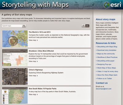 |
| ESRI's Storytelling Maps page |
Storytelling with Maps
I was recently introduced to a few ESRI resources that help students learn about past and current events through maps and GIS data. An excellent resource is ESRI's Storytelling with Maps. There, you can explore topics ranging from Fracking /Shale Gas Boom to The Real Pirates of the Caribbean to Health Care. You can even explore costs by state under the Federal Healthcare Exchanges initiative (i.e., Affordable Care Act/Obamacare). Exploring these topics digitally through time and space is a great opportunity for students to begin learning how to interpret data and maps.
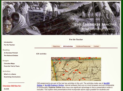 |
| ESRI's Time and Place Module: Indian Removal Act of 1830 |
Additional Resources
ESRI also has some additional resources worth mentioning. Their "Time and Place" modules include topics such as the Dust Bowl and the Indian Removal Act of 1830. Students are provided maps and documents as a way to integrate information from a variety of sources to form an argument. (Notice the potential Common Core connection here?)
GIS Jobs
Finally, those not sure why GIS should be part of the curricula in secondary schools need only be reminded on how many public and private sectors use this information. ESRI provides several snapshots of these GIS-related jobs, too (e.g., farming, military, retail stores). P-12 education is catching up with this approach to geography, and these (and other) free resources are making this topic more accessible to schools on tight budgets. Happy exploring...
- New Release - U.s. Census Bureau International Population Data And Maps
From my colleague Joshua Comenetz at the Census Bureau--fascinating data! The Census Bureau has added to and updated the online collection of subnational population data linked to maps (shapefiles) that are available at the Spatial Data Repository. The...
- Primary Sources, Primary Sources, Primary Sources...
It's that time of the semester when my students are hurriedly (and thoughtfully, I hope) developing lessons and units with primary sources. Of course, any web search will yield millions of hits, but finding and organizing these sources into a thoughtful,...
- More Geography Resources
Here are a few additional geography resources of note. In a previous post, I mentioned the National Geographic Xpeditions site, which is a great spot to find lessons and print-friendly maps. Another place to get maps, including "Maps with Historical Themes"...
- Free Gis With Google Earth
Recently, I've been learning how to use GIS software, namely ArcGIS, to figure out more ways to include these tools in my methods courses. I agree with the literature that--in terms of pubic school curricula--this powerful tool takes Geography beyond...
- Mind Maps®: Learning Skills From Mindtools.com
Source: http://www.mindtools.com/pages/article/newISS_01.htm Mind Maps®A Powerful Approach to Note-Taking (Also known as Mind Mapping, Concept Mapping, Spray Diagrams, and Spider Diagrams)"Mind Map" is a trademark of the Buzan Organization (see...